GIT/GIS: Between Digital and Smart
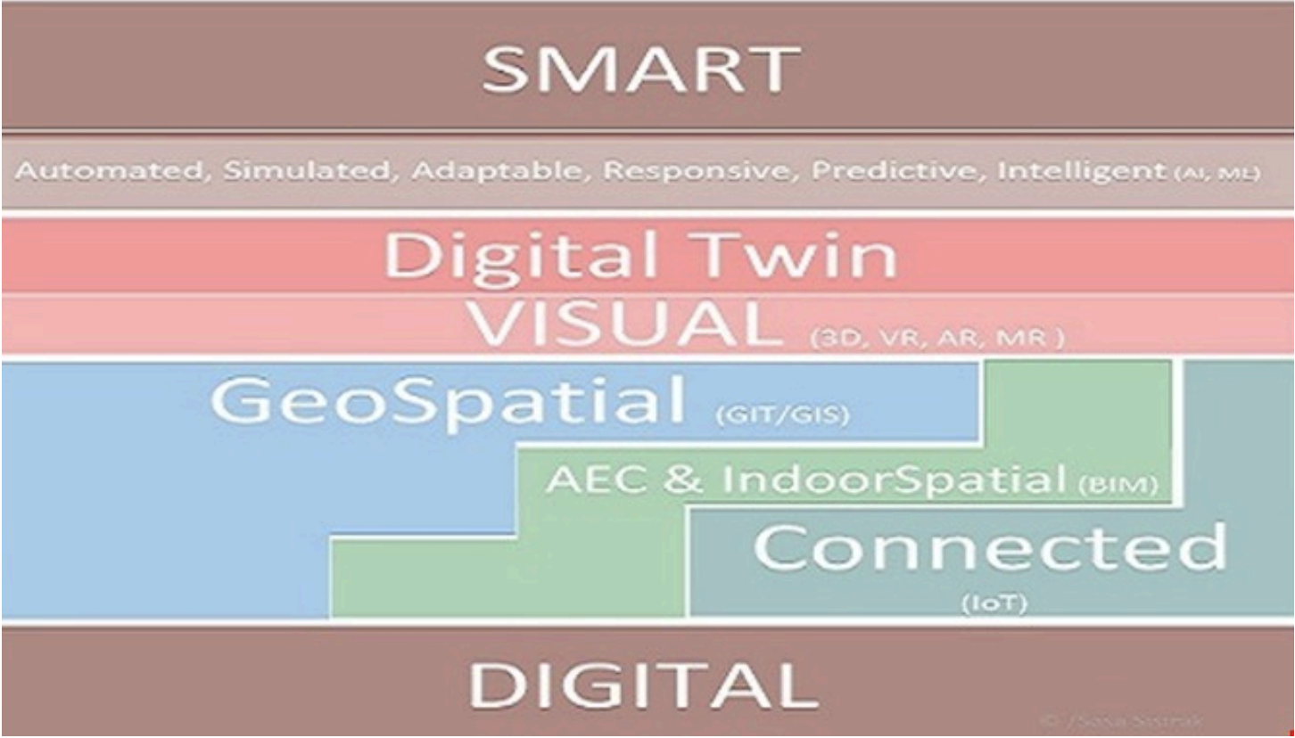
GIT/GIS: Between Digital and Smart
The conversation around digital transformation is everywhere, yet clarity on what it truly means, and where it leads, remains elusive for many organisations. This post explores the relationship between "digital" and "smart," and how the geospatial dimension (GIT/GIS) plays a central, and often overlooked, role in bridging the two.
The Concept
The theme is not a single topic but rather a collection of interconnected subjects tied together into one overarching concept. Through this lens, we aim to capture a holistic perspective on what characterises the many different dimensions between digital and smart technology and society. Our hope is that readers will come to recognise how the geospatial dimension is not merely a supporting element but potentially a central one in the journey from digital to smart.
From Digital to Smart
The shared understanding is that digitalisation is here, it is ongoing, and it will continue to affect all aspects of our lives, directly or indirectly. Some key questions worth exploring include: How does something become digital? What conditions are required? What do the different steps in a transformation process look like in order to achieve a higher level of digitalisation? And once the "digital" level has been reached, what do the milestones on the road to "smart" look like?
In some applications, particularly within urban development and construction, efforts are being made to move beyond the digital by integrating spatial information into digital concepts, connecting various phenomena regardless of whether the concept relates to a building or facility (BIM) or to a larger area (GIS), or both simultaneously. In most cases, some form of spatial information will be integrated, often combined with real-time data.
The Role of Real-Time Data and Digital Twins
As sensor technology and the infrastructure between sensors and applications (IoT) continue to develop, real-time data combined with other spatial, descriptive, and documentary data is increasingly being brought into digital mapping, visualisation, and analytics platforms. Such a platform is commonly referred to as a digital twin, and these twins can represent both small systems such as individual properties and large systems such as entire cities.
Toward a Smarter Future
It is broadly agreed that there is a shared vision of achieving local and global goals, becoming more efficient and precise, and creating the conditions necessary to meet the objectives of Agenda 2030 and the UN Sustainability Goals. With the evidence of how digitalisation has already influenced and will continue to influence the achievement of these goals, the next phase has already begun, in which digital technology alongside other technologies such as AI and machine learning becomes not the destination but the foundation on the path towards what we call "smart."
The most important insights tend to emerge not within any single area of technology, but in the connections between them. It is at those intersections that the common thread between digital and smart is most clearly found, and where geospatial capabilities consistently prove their value.
Conclusion
The path from digital to smart is not a straight line, and it is rarely travelled alone. Geospatial technology, when properly integrated, acts as a connective layer that brings together data, context, and real-world meaning in ways that purely digital approaches cannot achieve on their own.
Interested in the intersection of GIS, digitalisation, and smart technology?
This is a space with enormous potential for industries ranging from manufacturing and real estate to urban development and beyond. If these themes resonate with challenges or opportunities in your organisation, we would be glad to explore them together. Get in touch to start the conversation.