Floor-aware Geospatial Digital Transformation
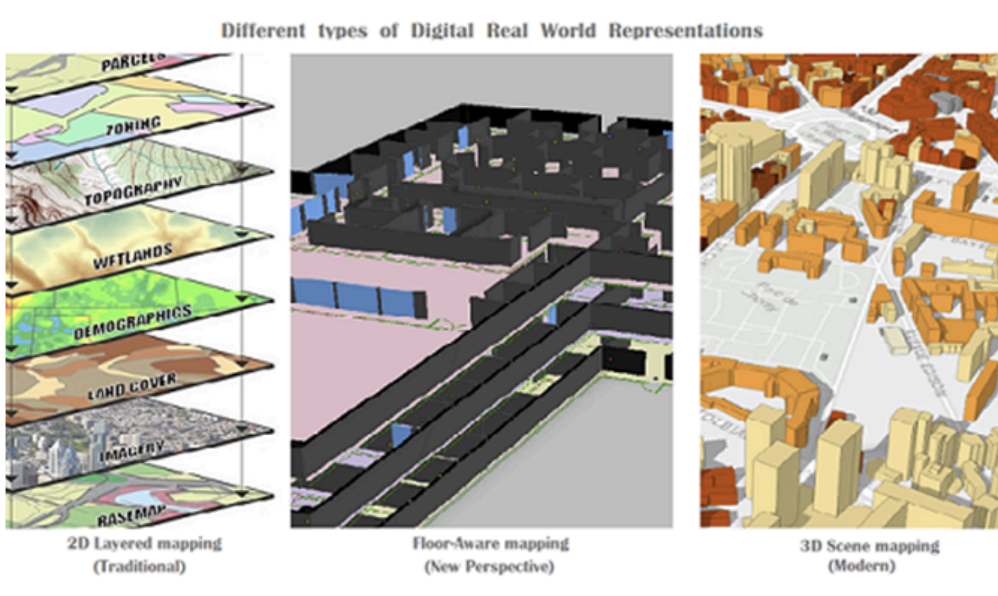
Floor Aware mapping capability of Indoor GIS gives new perception on digital transformation
In the age of digitalisation, even businesses deeply ingrained in digital technology seek to enhance their processes further, embracing the development of digital twins tailored to specific business cases. A digital twin was once primarily a visually oriented tool, offering a digital representation of real-world entities. This digital journey, from mapping the real world to leveraging the geospatial capabilities behind real-world entities to constructing geospatially enabled digital twins, can be significantly advanced by introducing a novel perspective: floor-aware mapping.
Evolution of GIS
Historically operating on two-dimensional geodata, GIS applications have evolved, with recent advancements transitioning many aspects into three-dimensional representations of the real world. Despite this evolution, GIS's reliance on layers of geodata spatially analysed in relation to one another has persisted. However, reality often involves levels of 2D geodata in 3D space, treated as floors with transitions between them, a concept already seamlessly integrated into both 2D and 3D CAD software.
Implementation of Floor-Aware Mapping
The integration of floor-aware mapping within Indoor GIS, coupled with the inclusion of floor plans in GIS designs, signifies a paradigm shift and a substantial enabler for those seeking to leverage GIS capabilities within specific areas of interest or business operations. Sites, facilities, assets, and people can now be geospatially and digitally represented in our digital models of the real world, with GIS seamlessly ingesting, processing, and analysing real-time data. Visualising outcomes for each level or floor, comprising numerous geodata layers, empowers organisations to identify practical and business-related activities, optimising efficiency and contributing to a more sustainable future.
Positioning Technologies
This transformative capability hinges on accurate indoor positioning, facilitated by various Indoor Positioning Systems (IPS) technologies, coupled with precise outdoor positioning methods including the Global Positioning System (GPS). The varying levels of precision inherent in these technologies and calculation methods underscore the importance of accurate positioning in realising the full potential of floor-aware GIS.
Floor-Aware GIS: A New Level of Business Capability
Floor-aware GIS introduces a new dimension to geospatial technology, enabling the creation of geospatial digital representations at a site or campus scale where many business applications previously operated without leveraging GIS capabilities. In the era of digital transformation, this elevation of digitalisation should not be underestimated. Organisations committed to innovation and future readiness stand to gain the most from embracing this shift.
Conclusion
Embracing floor-aware mapping is not merely a technological advancement; it is a strategic move towards more complete digital transformation and a more sustainable, efficient future.
Ready to Take Your Digitalisation to the Next Level?
If you are exploring how floor-aware GIS and geospatial digitalisation could transform your operations, we would love to hear from you. Whether you are at the beginning of your digital journey or looking to elevate an existing approach, our expertise in innovative location-based solutions can help you unlock new dimensions of efficiency, visibility, and sustainability.
Get in touch to start the conversation.